 Catalogo de metadatos del IGME
National Energy and Geology Laboratory, I.P. (LNEG)
Type of resources
Available actions
Topics
Keywords
Contact for the resource
Provided by
Representation types
Update frequencies
status
Scale
-
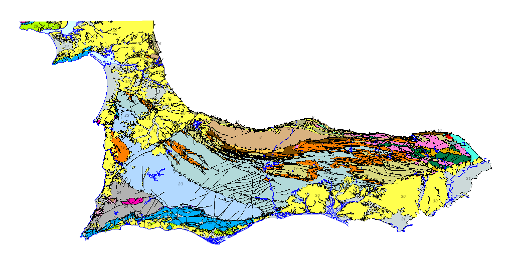
Geological map of the South Portuguese Zone, at a scale of 1/400,000, in which the geological legend on both sides of the border has been harmonized, with unified criteria between Spain and Portugal. This cartography is a product resulting from the GEO_FPI project: GEO_FPI: cross-border observatory for the geo-economic evaluation of the Iberian Pyrite Belt, financed by the European Regional Development Fund (ERDF) within the program INTERREG V-A Spain– Portugal (POCTEP) 2014-2020. The main beneficiary of the project is the Geological Survey of Spain (IGME). Additionally, the General Directorate of Industry, Energy and Mines of the Ministry of Employment, Enterprise and Commerce of the Andalusian Government (JA) and the Portuguese National Laboratory for Energy and Geology (LNEG) and the Municipal Chamber of Aljustrel (CMA) are partners of the project.
-
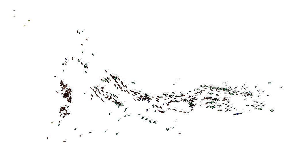
Metallogenic map of the South Portuguese Zone at a scale of 1 / 400,000, in which on the harmonized geological basis, with unified criteria between Spain and Portugal, the main metallic mineral occurrences located in the area have been represented, indicating their magnitude, substance and morphology. This cartography is a product resulting from the GEO_FPI project: GEO_FPI: cross-border observatory for the geo-economic evaluation of the Iberian Pyrite Belt, financed by the European Regional Development Fund (ERDF) within the program INTERREG V-A Spain– Portugal (POCTEP) 2014-2020. The main beneficiary of the project is the Geological Survey of Spain (IGME). Additionally, the General Directorate of Industry, Energy and Mines of the Ministry of Employment, Enterprise and Commerce of the Andalusian Government (JA) and the Portuguese National Laboratory for Energy and Geology (LNEG) and the Municipal Chamber of Aljustrel (CMA) are partners of the project.
-
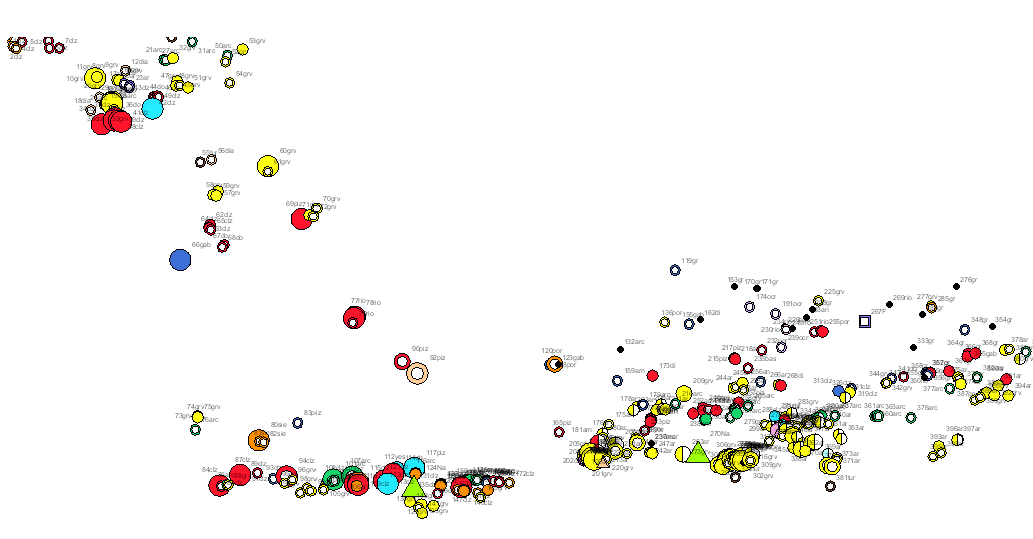
Rocks and industrial minerals map of the South Portuguese Zone in which on the harmonized geological base, with unified criteria between Spain and Portugal, the main non-metallic mineral occurrences and nonmetallic and industrial mineral mines in the area have been represented , indicating its status (active, abandoned or intermittent), size, use and substance. This cartography is a product resulting from the GEO_FPI project: GEO_FPI: cross-border observatory for the geo-economic evaluation of the Iberian Pyrite Belt, financed by the European Regional Development Fund (ERDF) within the program INTERREG V-A Spain– Portugal (POCTEP) 2014-2020. The main beneficiary of the project is the Geological Survey of Spain (IGME). Additionally, the General Directorate of Industry, Energy and Mines of the Ministry of Employment, Enterprise and Commerce of the Andalusian Government (JA) and the Portuguese National Laboratory for Energy and Geology (LNEG) and the Municipal Chamber of Aljustrel (CMA) are partners of the project.